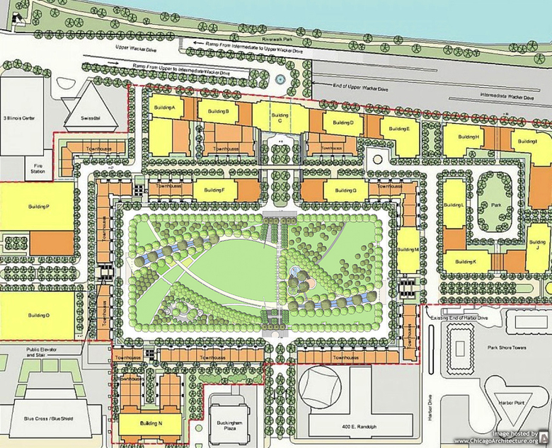
As part of the Vectorworks Design Summit that took place in Chicago from April 25th to 27th, Kyle Fiddelke, Principal at The Office of James Burnett (OJB), presented "Integrating Technology while Designing for the Public," focusing on the nearby Park at Lakeshore East.
Completed in 2005, the Park at Lakeshore East sits at the center of the 28-acre Lakeshore East development that is located just east of the Loop and north of Millennium Park. It is a prime spot that served as a rail yard for most of the city's history, since the Illinois Central Railroad was given land east of Michigan Avenue in the late 1800s. The long and fascinating history from rail yard to residential towers around a park was described in Fiddelke's presentation through some historical aerial photographs, a few collected here.
The 1960s photograph above shows the empty site of Lakeshore East, while in the foreground is a network of train tracks that would eventually become Millennium Park, Chicago's greatest urban accomplishment this century. The 1970s photograph shows the realization of some buildings at Illinois Center, adjacent to the area that will become Lakeshore East, but also the presence of Lake Shore Drive before it was rerouted to the east. More buildings are visible in the 1990s photograph, as is a 9-hole golf course that occupied the land for about a decade. The last photo shows how a high-rise community has grown on the once-industrial land, all arranged about the park at its core.
Fiddelke then discussed some nearby landscapes (Millennium Park, Daley Bicentennial Plaza – now Maggie Daley Park – and the Cancer Survivors' Garden) before moving on to the development of Lakeshore East. After agreeing to buy the 28 acres in 1998, Magellan Development Group hired Skidmore, Owings & Merrill (SOM) to create a master plan, which was completed in 2002. Although some of the elements of their plan have changed over the years (namely the townhouses ringing the park), the 5.3-acre park has remained its heart.
To date, just over half of the $4 billion development has been built – all of it following the completion of the park. (Notable buildings include Jeanne Gang's Aqua Tower, theneighboring GEMS World Academy Lower School by bKL Architecture, and Gang's forthcoming Wanda Vista Tower.) Building the park first was a mandate by the city that also would entice condo buyers by giving them a place to go and something to look at once they moved there. The developers figured people would gravitate to high-rise units facing the lake, but Fiddelke said the opposite was often the case: people first bought the apartments overlooking the park.
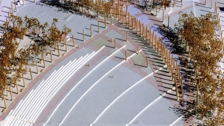
This park-first timeline also elevated the importance of landscape over that of building and allowed the park to shape the identity of the development. As Fiddelke explained, James Burnett found inspiration in the sail boats on Lake Michigan, establishing the sweeping arcs that connect the corners of the park.
Another important decision involved the placement of the park relative to grade. Lakeshore East is located directly east of Illinois Center, a primarily office development built on air rights over the rail yards starting in the early 1970s. A triple-tiered network of streets has made Illinois Center an unfriendly place for pedestrians. So when it came time to plan Lakeshore East, the park went against precedent and was located at grade, which brought costs down and made it easier to build the park first. With this location the buildings around the park (first townhouses but now predominantly high rises) make the transition from high to low, from perimeter streets to park and streets in the middle. Those attending the Vectorworks Design Summit experienced this firsthand, in the one-block walk from the hotel in Illinois Center to the panoramic view (top photo) of the Park at Lakeshore East from the base of the Aqua Tower.
Fiddelke asserted at the start of his talk that OJB has been using Vectorworks since the firm's inception, back when the software was called MiniCad. Although OJB was using MiniCad for the Park at Lakeshore East, the same lessons that were brought up in more recent projects in the talk (Devon Energy, Myriad Botanical Gardens and Project 180 in Oklahoma City, Klyde Warren Park in Dallas) apply here as well. These integrations of the technology into the design process include 3D modeling combined with Photoshop; easily illustrating design iterations through the use of layers (ideal for community meetings); printing out plans in b/w and coloring over them by hand to give them more appeal; and printing out color site plans and mounting them on foam core to give models some punch.
After completing DD (design development) documents with the software, OJB handed the computer files over to a local landscape architecture firm that handled the final documentation and construction administration. As Fiddelke described in a Vectorworks case study on the Park at Lakeshore East, "Our role was to establish the design intent, so the Vectorworks technology worked perfectly. It did exactly what we needed it to do." The success of the park more than one decade later attests.
World-Architects is the Exclusive Media Partner for the Vectorworks Design Summit 2016, taking place in Chicago 25-27 April 2016. Read all of our coverage of the Summit here.


